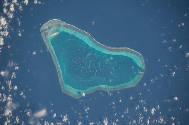
Where are the boundaries of the South China Sea?

Carilyn Pointer – China attempts to exert control over a vast majority of the South China Sea by putting barriers around the Scarborough Shoal. In response, the Philippine Coast Guard has sent divers to cut down the barriers. Understanding the basics of boundaries and territoriality can provide valuable insight into the conflict.
Boundaries are dividing lines between states. Oceans have their own form of territoriality, which helps to distinguish between what are considered national and international waters. The Scarborough Shoal is small 26-mile triangle chain of reefs located closest to the Philippine islands. Despite its proximity to the Philippines, it has been a source of conflict as both countries attempt to lay claim to the territory. Most recently, the Philippine Coast Guard has cut down the barriers China placed, citing that “The barrier posed a hazard to navigation, a clear violation of international law.” Typically, within 200 nautical miles of a land- based territory is considered a state’s exclusive economic zone (EEZ). Within this zone, a country has the right to resources such as fish and oil. By this definition, the Philippines have claim to this area, while China does not. However, China keeps trying to expand their territory by claiming other countries such as Taiwan as their own. Their success in expansion could increase the area of their EEZ and therefore the resources they have access to, as well as increasing their area of control.
While many may argue that the Philippines was justified in cutting the barrier down, it is still uncertain how China will respond since they consider the shoal and the surrounding waters to be “China’s inherent territory.” Will they militarize their waters, restrict trade even more, or will they turn the other cheek? If China does respond aggressively, how can the Philippines best respond in order to protect their territory?
Photo Credit: Dristributed via Public domain, Earth Science and Remote Sensing Unit, Lyndon B. Johnson Space Center.

